
Remote Sensing Satellite Data & Tools: Active, Passive, Microwave
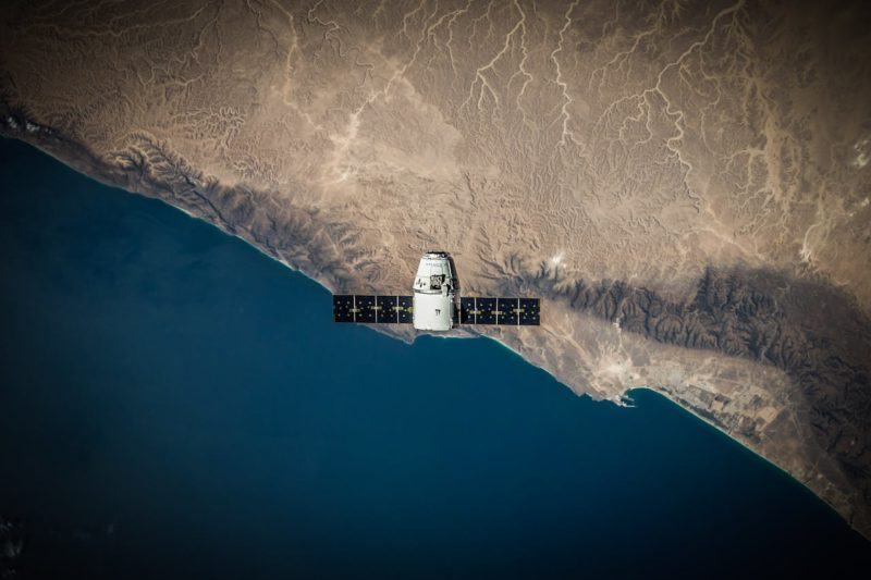
Remote sensing technologies have been a part of our daily lives for decades now. Maps and navigation depend on remote sensing satellite data; weather forecasting would not be possible without it either. Keeping track of any natural anomalies like fires and floods also happens with earth sensing satellites. Remote sensing tech keeps improving every day; for example, companies such as EOS Data Analytics and Dragonfly Aerospace already operate advanced Earth observation and AI-driven analytics systems that support modern agriculture and environmental monitoring. But what is remote sensing tech really about? Read a brief overview of active and passive remote sensing types below.
Active Remote Sensing
Active remote sensing implies that any tools involved in this process can emit light or waves of their own. In contrast to that, passive remote sensing relies on other objects reflecting light or waves (more about that later). Several instrument types do the active remote sensing, i.e.:
- Radar: perhaps, the most established remote sensor on this list, radar uses an antenna for emitting pulses. Whenever these remote sensing pulses come across an obstacle, part of them scatters back to the original source. As a result, one can estimate how far and where the target (or an obstacle) is. This figure is calculated based on the amount of returned impulses.
- Lidar: lidar sends out light impulses and uses them to measure the distance to other objects. Like radar, this tool measures the retrieved quantity, multiplying the time by the speed of light.
- Laser altimeter: can estimate elevation using lidar technology, typically for terrain mapping and surface height measurements.
- Ranging instruments: these systems measure distance using signal travel time between a transmitter and a reflector or transponder.
- Sounder: is a tool used in meteorology and atmospheric science. It measures vertical profiles of the atmosphere by analyzing emitted or reflected radiation at different wavelengths to derive temperature, humidity, and pressure rather than directly measuring them.
- Scatterometer: this device measures backscattered microwave signals by sending pulses of its own and analyzing the returned signal strength and polarization.
One of the greatest advantages of using active remote sensing tools is that they are relatively independent. Since they emit signals of their own, they can function without natural sunlight and are comparatively independent when it comes to atmospheric fluctuations.
Today, active remote sensing is used not only for scientific research but also for more practical purposes. For example, the Shuttle Radar Topography Mission collects data on our planet’s elevation levels. Lidar helps model the Earth’s surface. Data obtained with satellite remote sensing helps foresters and marines organize rescue missions. Atmospheric sounders are also essential for weather forecasting, providing vertical profiles of atmospheric conditions.
Modern active remote sensing also includes Synthetic Aperture Radar (SAR) systems, which allow high-resolution imaging of Earth’s surface through clouds, darkness, and adverse weather conditions. This makes SAR critical for flood mapping, ground deformation monitoring, and disaster response.
Passive Remote Sensing
Passive remote sensors cannot emit signals or light of their own, so they depend on natural energy (usually, sunlight) reflected or naturally emitted from objects on Earth. Simply put, these sensors can only be used during the day when there are enough sun rays to reflect. Passive remote sensing system tools employ multispectral or hyperspectral sensors that measure a wide array of parameters. They analyze the bounced sunlight by band combinations. The latter may differ by the number of channels (two or more). And even though passive remote sensors depend on sunlight, the waves they measure are outside the human scope of visions.
The most useful instrument for passive remote sensing are:
- Spectrometer for analyzing spectral bands
- Radiometer to measure visible, infra-red, or microwave bands and establish the level of radiation
- Spectroradiometer to determine the level of radiation in several band ranges
- Imaging radiometer to scan surface objects and reproduce their images
- Hyperspectral radiometer to differentiate between narrow spectral bands. This is the most precise passive tool to date.
While it may seem that passive instruments are not as versatile as active tools, they are still very useful in our daily life. For starters, remote sensing examples in the passive category can really stand the test of time — take Landsat, for instance. It remains the longest-running Earth observation program, operating since 1972 (over 50 years of continuous data collection) and has helped us observe planetary changes over decades. The latest mission, Landsat 9, continues this data record.
Passive tools are widely used in forestry, mapping, ecology, and other areas. Commercial agriculture relies heavily on remote sensing satellites and their spectral indices for yield forecasting. Modern systems increasingly combine passive satellite data with AI and machine learning models to improve crop prediction, drought monitoring, and land-use classification.
Microwave Remote Sensing
Microwave sensors can be both active and passive. Here, the emphasis is on the wavelength that may vary from about 1 mm to 1 m, including the modern millimeter-wave region used in high-resolution sensing systems. The longer the wave is, the easier it is for the wave to break through atmospheric conditions like clouds or rain.
Passive microwave sensors measure naturally emitted microwave radiation from Earth’s surface and atmosphere. Unlike optical systems, they work day and night and in all weather conditions. Their main applications include monitoring soil moisture, sea surface temperature, ice cover, and atmospheric water vapor.
Active microwave sensors emit signals of their own and analyze the returned echoes. These systems include imaging tools such as radar and Synthetic Aperture Radar (SAR) and non-imaging tools such as scatterometers and altimeters. Scatterometers are commonly used to measure ocean wind speed and direction, while radar altimeters measure surface elevation of oceans, ice sheets, and land.
Microwave remote sensing is widely used in marine studies, meteorology, cryosphere research, and disaster monitoring due to its ability to operate in all weather conditions.
Modern Developments in Remote Sensing
Modern remote sensing has evolved significantly with the rise of:
- Small satellite constellations (CubeSats) that provide high-frequency Earth observation with low-cost deployment
- Artificial intelligence and machine learning, which automate image classification, object detection, and environmental change analysis
- Near real-time monitoring systems, enabling rapid response to wildfires, floods, and deforestation
- Data fusion techniques, combining optical, radar, and thermal datasets for more accurate insights
These developments have transformed remote sensing from a primarily scientific discipline into a real-time commercial and environmental intelligence system.
Conclusion
As you can see, the number of active and passive remote sensing techniques is already impressive. What’s more, these technologies keep moving forward, especially with advances in SAR systems, AI-based analysis, and satellite constellations, so we should soon have an even better understanding of our planet and its resources.
Would you like to receive similar articles by email?
Paul Tomaszewski
Paul Tomaszewski is a science & tech writer as well as a programmer and entrepreneur. He is the founder and editor-in-chief of CosmoBC. He has a degree in computer science from John Abbott College, a bachelor's degree in technology from the Memorial University of Newfoundland, and completed some business and economics classes at Concordia University in Montreal. While in college he was the vice-president of the Astronomy Club. In his spare time he is an amateur astronomer and enjoys reading or watching science-fiction. You can follow him on LinkedIn and Twitter.


You May Also Like
NGC 7822: A Cosmic Question Mark
Eta Eridanid Meteor Shower Guide